Newmarket Heath
- As explained on the page for the Origins
of Newmarket, the creation of the town came about because
it was directly on the route of the Icknield Way, an ancient traveller's route
(now the A11/A14) across what geologists
call the Cambridgeshire Chalk Plain,
the East Anglian Plain or for our particular part of it, the Newmarket Chalk Heath
- i.e the heathland that we know so well.
Water seeping out from north-east / south-west oriented underground chalk aquifer produced wells, located on the side of the gentle chalk embankment, which to the south-east becomes what's rather grandly known as the East Anglian Heights (all of which are only a few hundred feet high) and then to the north-west leads down to the vast expanse of the Fens, which in times past were mostly flooded, or were at least covered in wet marshland.
So this chalk ridge created a 'Goldilocks Zone', an area beneficial for safe and dry occupation, but with easy access to a source of fresh water, far enough away from what was originally mosquito-ridden marshland, and with much easier direct access than the rolling hills stretching out into Suffolk.
- This gently-rolling grassy chalk heathland had another important benefit
for Newmarket, particularly for the sport that it's become best
known for - it was very good ground for hunting, particularly on
horseback .... and through subsequent Royal patronage, over at least
three and a half centuries, the sport of horseracing.
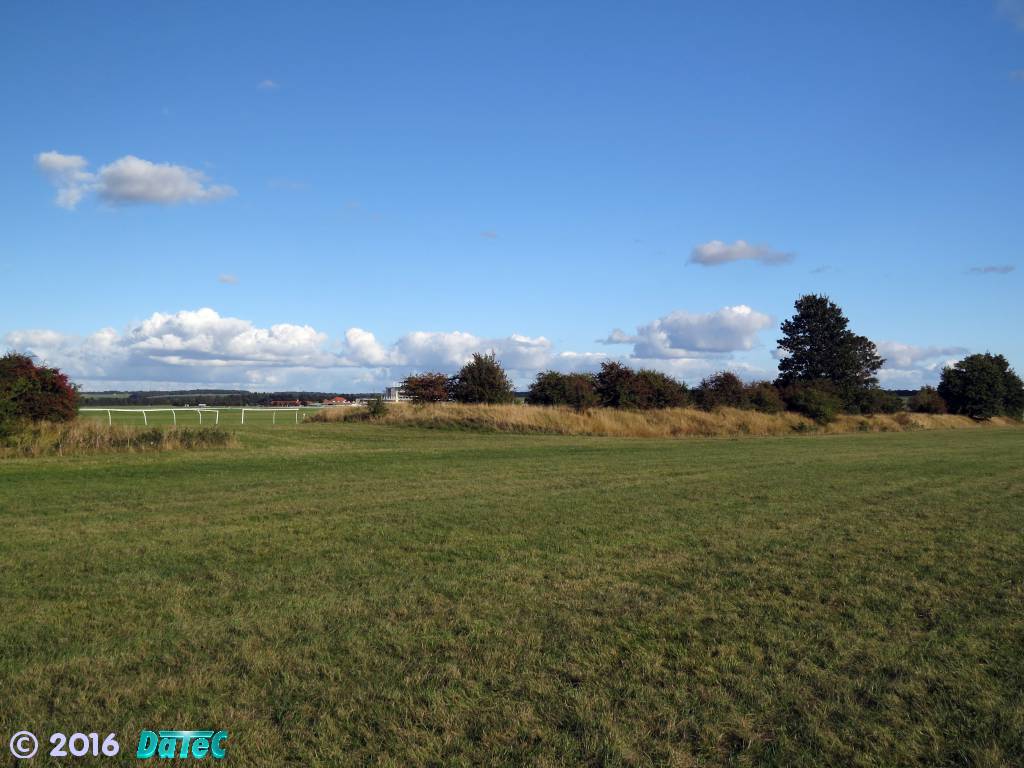
- Newmarket has heathland to both the west and east, and in pure
terms this is all the 'Newmarket Heath', but from a cartology (map-making)
aspect these are split into different named areas. The land to the east
has mostly been used for the training of horses and this has
numerous names - Warren Hill, Side Hill, Long Hill, Bury Hill (the
beginnings of the 'Heights' described above), the Limekilns (yes
this was at one time the location of limekilns - where limestone was
burnt in order to make lime mortar for use as a building material), Water Hall (getting
closer to the fens) and the Railway Field - an area that was
segregated from the fens by the coming of the railway to Newmarket
in 1848.
To the west of the town the maps call this area the Newmarket Heath ... I personally call it the Cambridge Heath, or Cambridge Road Heath, as do many other locals (it's closest to Cambridge), and the maps do show an area called Cambridge Hill. This is the area of the Newmarket Heath that this page is going to describe in more detail.
Though traditionally it was the location of the multitude of Newmarket Racecourses (more about them on the page for the Newmarket Racecourses), over the years this area has also seen many other uses.
-
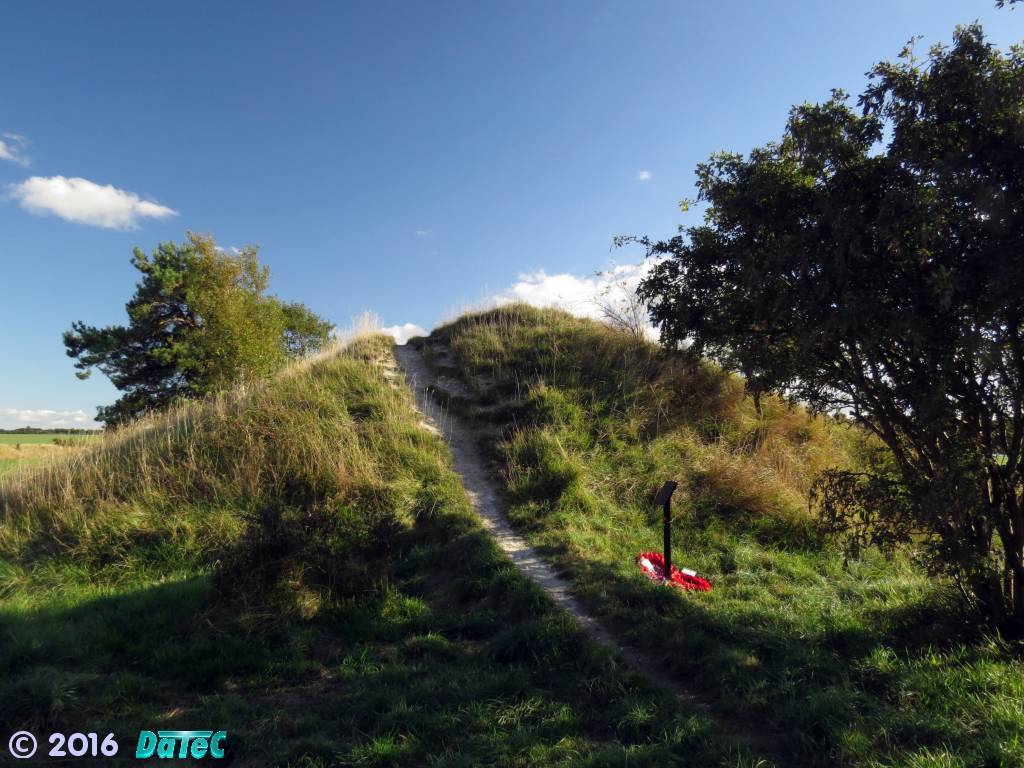
The Devil's Dyke
- The western edge of the Newmarket Heath is strongly demarked by the
visually striking Devil's Dyke,
which present opinion has-it that construction of this most likely started during Roman times
(50 CE onwards). It's thought to have been a way of restricting travel along the Icknield Way (see the
Origins page again).
The Icknield Way though was not a Roman Road per se (although they most probably made use of it) - it's much older than that, so the exact original purpose of
this Dyke isn't entirely clear.
Similarly to the details shown in the sectional diagram above for the Fleam Dyke, archaeological carbon dating indicates a continual change in height and structure of the Dyke over the years and large parts of the chalk embankment and associated ditch show strong associations with the Kingdom of the East Angles (now Norfolk and Suffolk), which was founded c.571 CE, and at that time the Dyke seems to have been a defensive line used by the East Angles against the other Saxon kingdoms.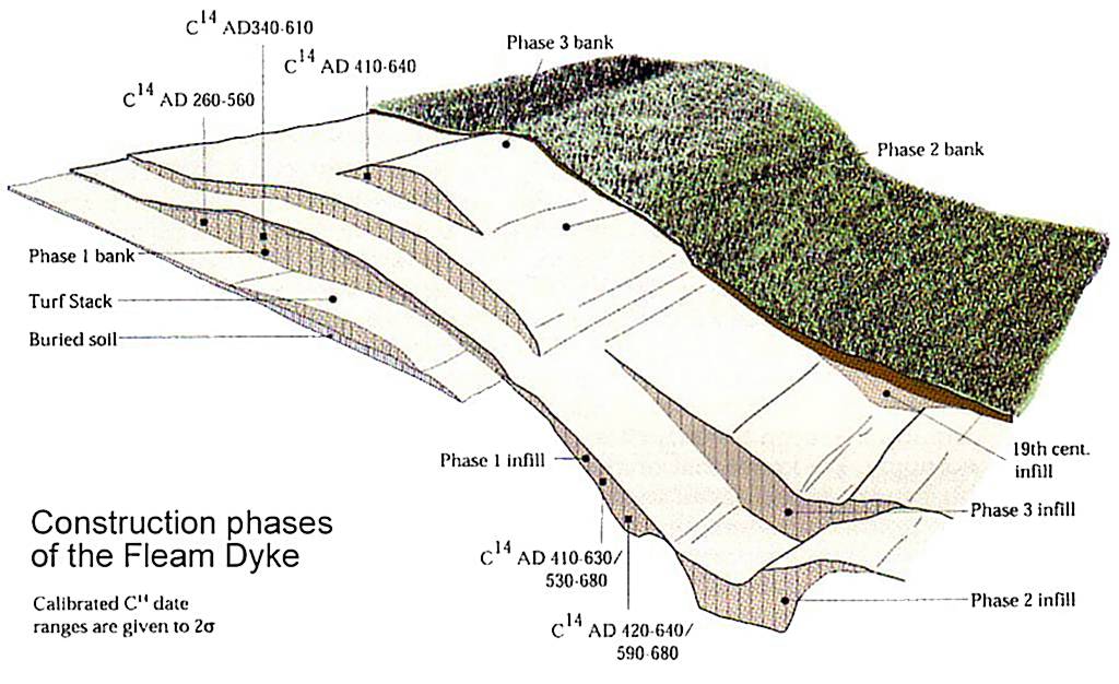
Carbon 14 dating of the nearby Fleam Dyke, showing the various layers and construction phases
[click on the image above for more details about the Fleam Dyke]
[2σ = two sigma = 2x standard deviations - this Wiki page helps explain the significance of these figures for Carbon 14 dating]
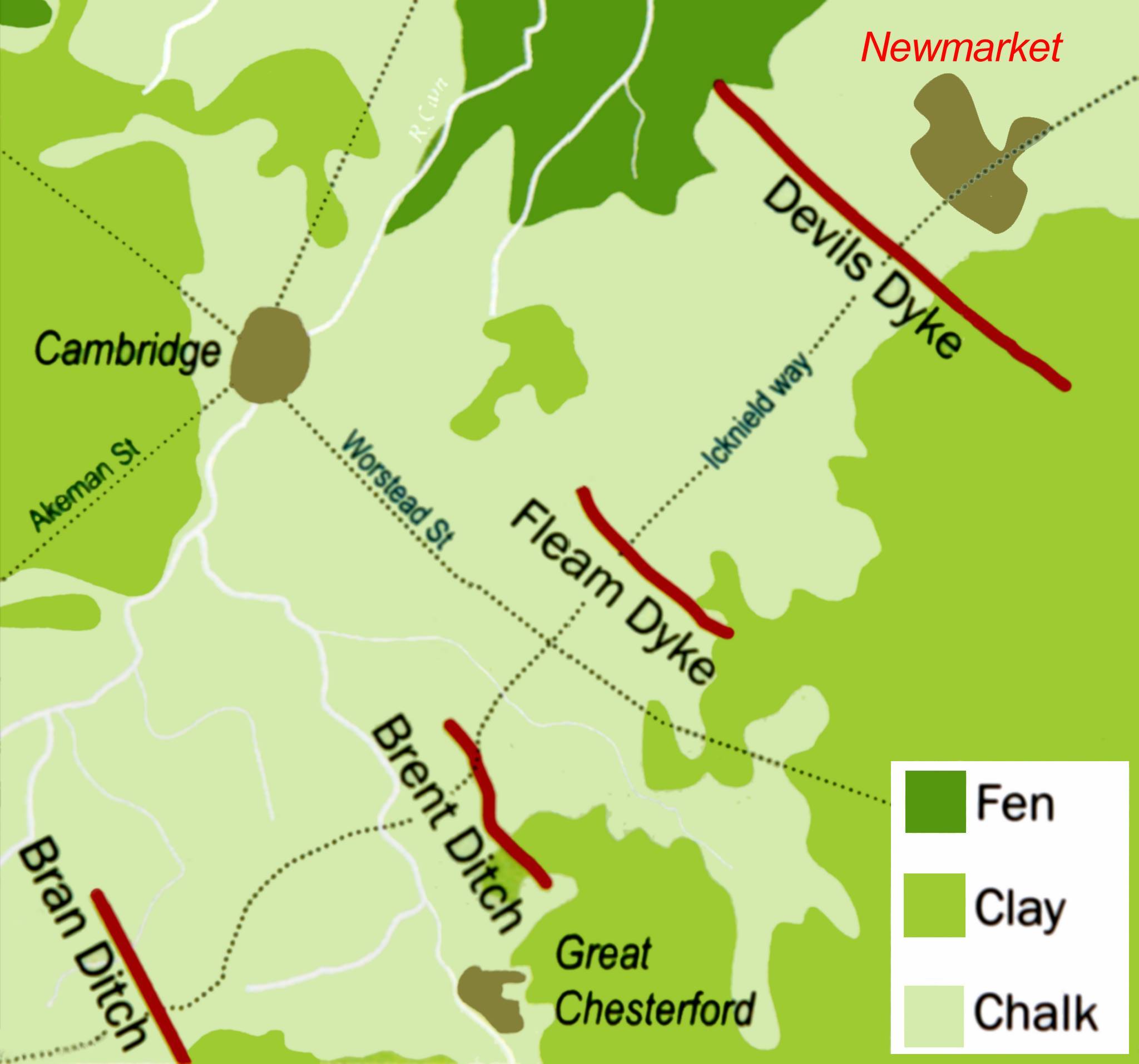
Map of the Cambridgeshire Dykes
A Roman coin excavated from the lower layers of the Devil's Dyke (found during the construction of the Newmarket Bypass - then the A45 now the combined A14 / A11) dates from c.350 CE ... which seems to fit very well with the Phase 1 bank shown in the above diagram. But then as also indicated for the Fleam Dyke there seems to be a turf stack underneath the main bank that could indicate an unknown and much earlier original construction at its very base - presently the jury's out on this one and further surveys will be needed to prove conclusively the origins of these dykes.
- Before anyone asks the question again, strictly speaking the
Devil's Dyke or Ditch is what it says it is - the ditch that runs
alongside the raised bank. The chalk from the ditch having been
dug out and mounded-up to form the bank (defensive or whatever),
and the ditch is always on the western side of the bank. But talk
to most people and they'll refer to the Dyke as being the 7 mile
long raised bank along which people walk ... with common phrases
such as "I'm going to take the dog for a walk up on the
Dyke" ... it's all a case of technical detail ... but as
it's all part of the same overall construction I think we'll just
have to take it as written that the whole of this marvelous 'line
in the chalk' is called the Devil's Dyke.
-
The Gaps
- The general opinion is that the Dyke was originally a continuous structure, designed to block the whole chalk
zone. Although it would seem most sensible that there was a gap of some form where the Icknield Way crossed
it ... though because of major subsequent alterations over many
years around this area there's no evidence left to show just how wide
or what shape the gap would have
originally been.
Hence none other the other gaps that are now present in the Dyke were originally there.
The Devil's Dyke stretches for 7.5 miles from Pickmore Wood at Woodditton to the east, past Newmarket and on towards the centre of Reach at the edge of the fens to the west - it would have been a formidable barrier.
At present there are 17 variously sized gaps that cut through the Dyke, which include two railway cuttings (one disused), five roads, a number of footpaths and one for Newmarket's Watercourse.
As shown on the map below, along the length that runs beside the Newmarket Heath, starting at the Icknield Way (now the combined A1303/A1304 - the London Road), these are called the London Road Gap, the Cambridge Gap, the Well Gap, the Stable or King's Gap and the Running Gap.
-
The largest of these gaps is the Running Gap and obviously this is now where the presently longest of
Newmarket's Racecourses, the Beacon Course, cuts
through the Dyke. Although there's also a train of thought that another of the ancient Briton footpaths previously cut through
at this same location, a track that traversed closer to the fens than the Icknield Way.
This one was called the Street Way, which passed close to Exning
after its passage through the Dyke - aiming for the spring-head
known as St Wendred's Well and then passing by Beech House Hospital
(the former Newmarket Isolation Hospital). Details about it can be
found in this archaeological report:-
 University of Cambridge Department of Archaeology Report No.1039 -
Beech House (8 MBytes)
University of Cambridge Department of Archaeology Report No.1039 -
Beech House (8 MBytes)
The page for the Origins of Newmarket discusses how the Icknield Way was never just one lone path, but a series of parallel tracks cutting across the country, and the Street Way was most probably just one of these alternative routes.
- Further details about the Devil's Dyke can be found on the following British History Online web
site:-
 http://www.british-history.ac.uk/rchme/cambs/vol2/pp139-147
- The question has been asked, "why, as stated on the above BHO web
page, was the King's Gap renamed the Stable Gap?" .... well I don't think
it's as simple as that.
The extract below is a page from an 1841 book called 'Salopia Antiqua' - this refers to it as the Stable Gap ... BHO states that the latest name is Stable Gap and that it was "called the King's Gap in the 18th century", but the background of the most recent map as shown in the 'Overlaid Map' image above calls it the King's Gap.
In the correspondence section of the NLHS web site - Page 7, Timothy Cox at the National Horseracing Museum has it "that the Dyke was broken through at that point to allow King Charles II's carriage to go through to view the races on his new Round Course." - this seems highly likely.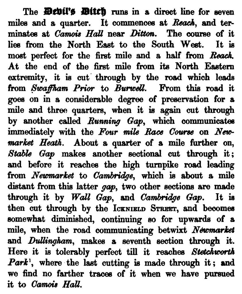
Extract from 'Salopia Antiqua : or, An enquiry from personal survey into ....'
Originally published 1841
But then the provenance for the painting from 1859 by the famous Newmarket equestrian painter Harry Hall, as shown below, also has it as follows:-
(More details about Harry Hall can be found on the page for his house Park Cottage, that stood where the Avenue is now.)- 'Gamester, owned by Sir Charles Monck and trained by John Scott, won both the Doncaster and Newmarket St. Legers in 1859. This picture records his victory at Newmarket on 28 September, only a fortnight after his win at Doncaster. Gamester is depicted on Newmarket Heath, set against the King's Gap in The Ditch and, to the right, the Ditch Stables. The unusually grand groom was presumably an assistant trainer or head lad to the aging John Scott, as he is neither the latter nor Sir Charles Monck.'
So from these records it's clear the that the chronological use of these two names is not consistent - i.e. it didn't just simply change from being called the King's Gap to then subsequently become the Stable Gap.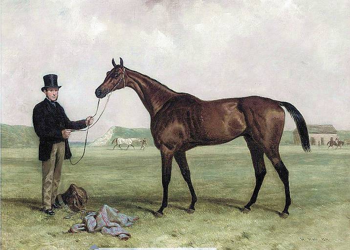
Gamester, by Harry Hall - 1859
The King's / Stable Gap - 2016
- the Ditch Stables have now long gone
The answer to this question though could most probably be found in the painting above - if you look closely you'll see that there's what they call the 'Ditch Stable' right next to the gap - so maybe the name that the gap was called just depended on who was referring to it at any particular time - i.e. stable lad or aristocrat - Stable Gap or King's Gap.
-
RAF at Newmarket
- Due to its large swathes of flat grassland Newmarket Heath was and
still is an ideal location to site an airfield.
Much has been written about it, and there are numerous online forums out there with deep and detailed discussions of how this area came to be used as RAF Newmarket during WWII, so this page isn't going to try and duplicate any of this, but will concentrate on just the outline details - the high and in some case lowlights of the RAF at Newmarket.
The co-contributor to this web site; Tony Pringle, with his Undying Memory military memorial web site is going to try and compile a more complete record of the many RAF mishaps that occurred at and around this airfield, but it's my Dad's childhood memories during the war and his time in the ATC that this web page will concentrate on.
- RAF Newmarket Heath was first used by the Royal Flying Corps in
1918-19 when the 190th and 192nd squadrons were based here.
It was the long stretch of grass adjacent to the Rowley Mile racecourse that made it an ideal RAF base for the much heavier bombers that became so important during WWII. Though the main runway here is often quoted as 7,500 feet (2,286 m) long, the overall length of 9,000 feet (2,743 m) came in pretty handy during the initial trials of Britain's first jet-engined aircraft; the Gloster Meteor (more details about that below).
In addition to the main east-west runway (Runway A) there's some evidence to indicate that there were 2 other runways here - an alternative south-east to north-west runway of 5,400 feet (1,646 m) (Runway B) and an alternative north-east to south-west runway of 4,800 feet (1,463 m) (Runway C). Use of these various runways at any time would have depended on the type of plane and the prevailing winds on any day ... see below for more details.
-
WWII commenced with the invasion of Poland on 1st September 1939 and
in the evening of that same day RAF No. 99 Squadron landed their Wellington bombers
here, un-announced.
In a transcript of an interview with Gloucestershire born Norman Didwell, part of the ground crew working on the planes, he relates that the planes dispersed around the edges of the racecourse ... which of course was much to the annoyance of the clerk of the course, who ran at the ground crew shouting "You can't park here this is a racecourse".
 http://www.newmarketjournal.co.uk/news/latest-news/we-lost-a-lot-of-good-men-1-549099
-
Subsequently the racecourse administration buildings were converted for use as
accommodation for the air and ground crews and the grandstand became
the mess hall. More permanent accommodation for the various RAF crew
members in other areas around Newmarket didn't come until much later.
The squadron flew many missions from here until they moved to Waterbeach in March 1941.
Coming under control of Stradishall it was then used for many SOE operations including the dropping of supplies and agents into occupied countries and picking-up of agents, politicians, resistance leaders and escaping airmen. Aircraft then included Westland Lysanders and Armstrong Whitworth Whitleys.
Various RAF, RNZAF (Royal New Zealand Air Force) and even RAAF (Royal Australian Air Force) squadrons were stationed here at various times during the war and this is just a short list of them:-
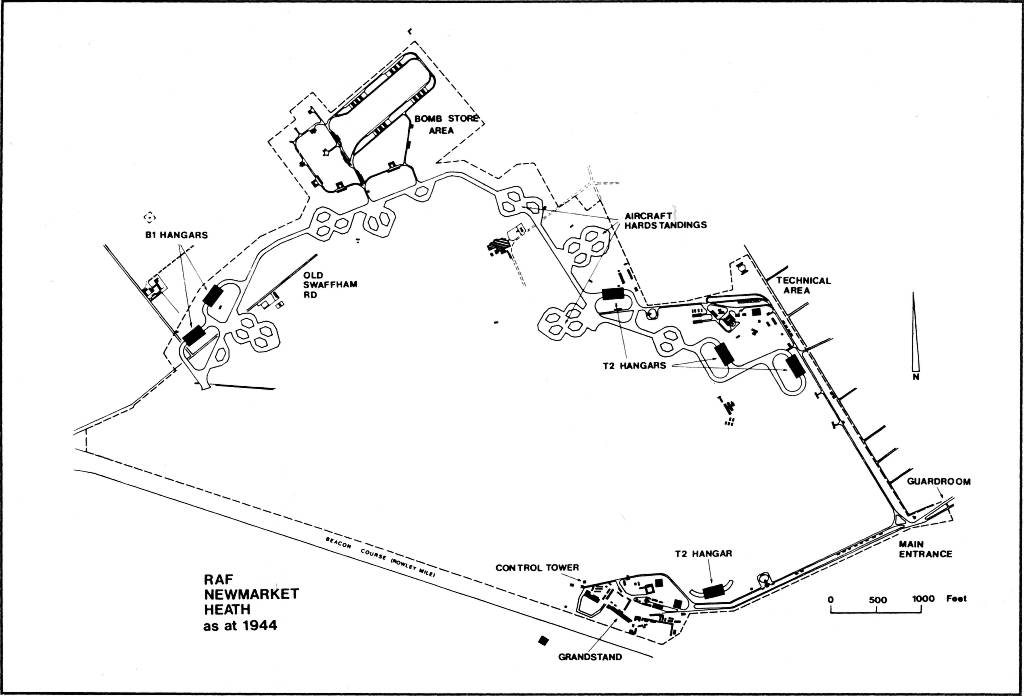
Compare this 1944 map to the 'Overlaid Map' of Newmarket Heath above, where the airfield map shown is from 1953
- the two B1 hangars detailed below can be seen on the centre left along the Old Swaffham Road
- of course the area just to the south of these has now been cut through by the very busy 6 lanes of the combined A14 / A11 Newmarket Bypass
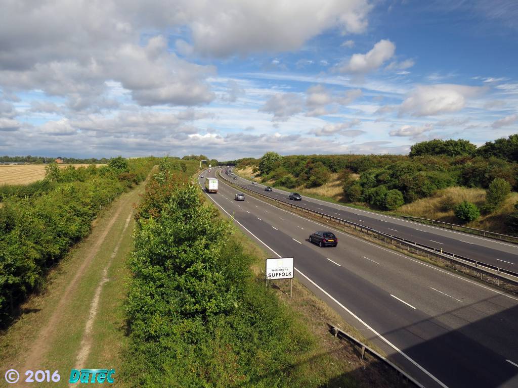
A14 / A11 Newmarket Bypass looking from the Devil's Dyke Footbridge,
the location where this photo was taken is just at the left-hand edge of the 1944 map above
- the Running Gap in the Dyke is just out of view on the right-hand-side behind the trees
- and the rough track on the left leads to the site of the B1 hangars
These 3 photos were taken on 4th September 2016
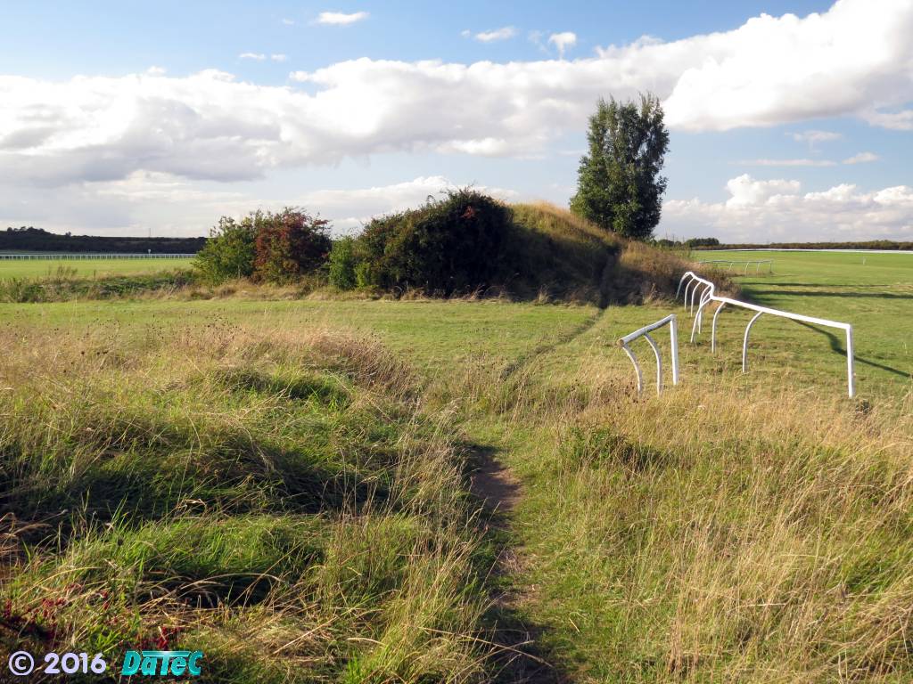
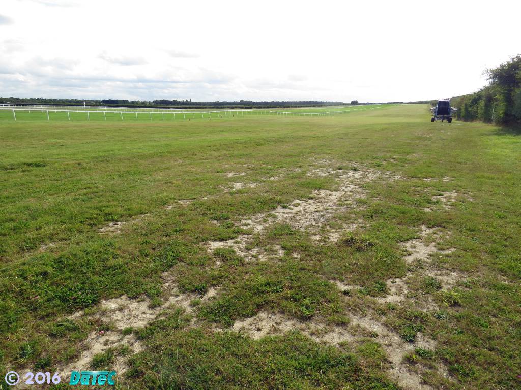
Looking through the Running Gap,
towards the start of the Rowley Mile Course
- the longest of the RAF runways would have come through here,
with aircraft on take-off aiming towards the Dyke on the left
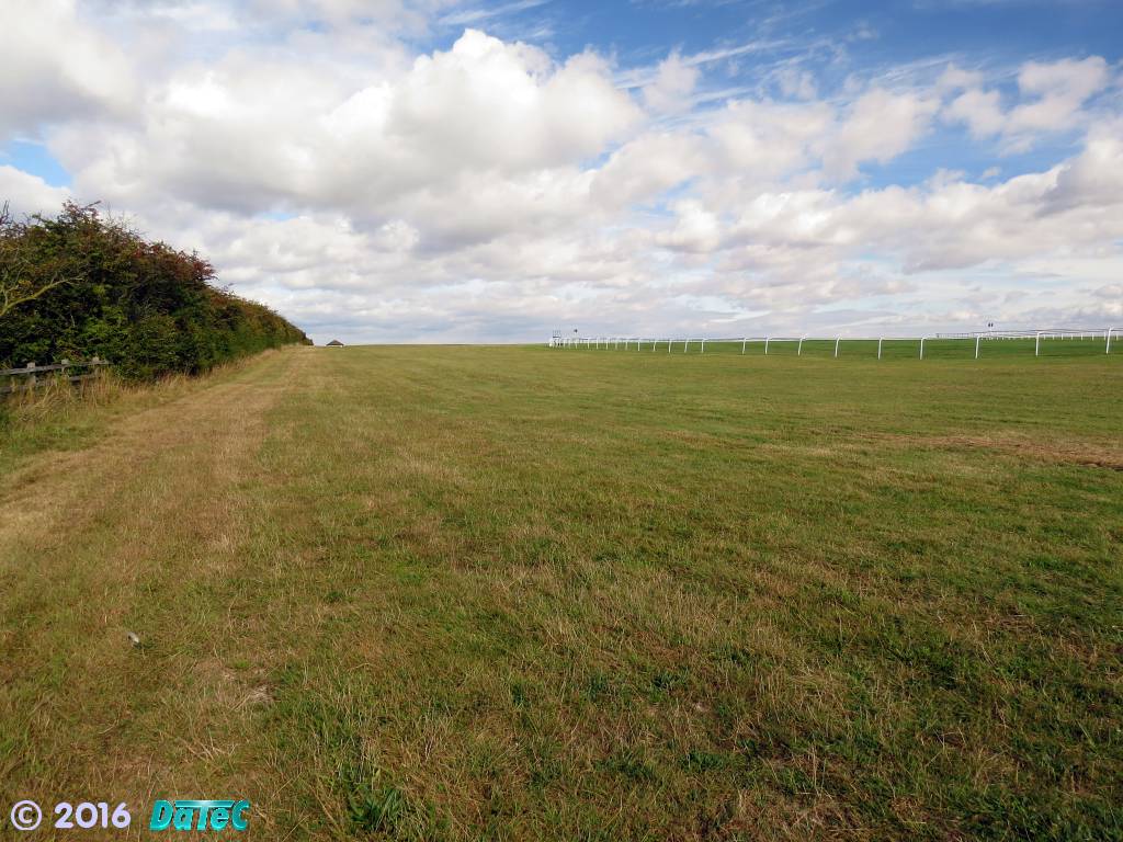
Looking through the Running Gap,
towards the start of the Beacon and Round Courses
- one of the starting gates can be seen parked-up on the right
-
Operational units and aircraft:-
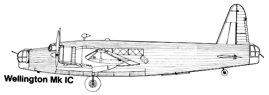
- No. 99 Squadron RAF (1st September 1939 until March 1941) -
Vickers Wellington I, IA & IC.
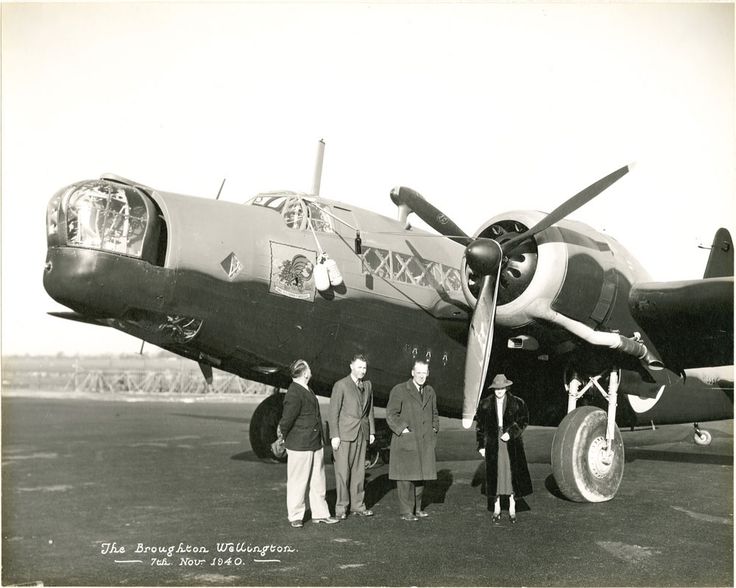
Vickers Wellington Mk 1C R1333 - the photo on the right above shows the 'Broughton Wellington'. This was paid-for by the contractors, sub-contractors and employees of the Broughton aircraft factory near Chester and cost £15,000. It was delivered to 99 Squadron at Newmarket on 1st December 1940.
17 days later, on 18th December 1940, as the plane was taking off for Ops: "B.55" to Ludwigshafen, it failed to gain height and hit the Devil's Dyke shortly after take-off due to an incorrect flap setting.
The pilot Flt Lt Glencairn Ogilvie, with second pilot Plt Off Arthur Pritchard RNZAF and rear gunner Sgt Bill Roast were killed, but front gunner Sgt George Lee and WOp Sgt Cliff Hendy were rescued by Jens 'Morian' Hansen, who was on flarepath duty at the time, for which he was awarded a George Medal.
[Note from webmaster - my Dad remembers being told about this crash just after it happened and hurrying up to the heath to see the aircraft laying in flames on the Beacon Course.]
- 3 Group Training Flight RAF.
3 Group Training Flight, later became 1483 Target Towing and Gunnery Flight, then 1483 (Bomber) Gunnery Flight: based at Stradishall, Newmarket and Marham. 3 Group headquarters were at nearby Exning House. The Group included No.75 Squadron, No. 138 Squadron, and No. 161 Squadron, further details about these are shown below.
6th January 1942
Vickers Wellington Mk 1C L7863
At 10:00 hours on this day Vickers Wellington L7863 took off from Newmarket for a gunnery detail training flight.
As the aircraft began to climb after take-off the port engine failed and the plane quickly lost height and crashed onto a nearby railway embankment before skidding into an adjacent building and bursting into flames.
All of the crew were killed, apart from 2 members who survived with injuries.
Crew:
Pilot: Flt/Sgt 903047 Frederick Thomas Miniken 25 RAFVR killed
Wop: Sgt 1200354 Reginald Alfred Butcher 29 RAFVR killed
Wop/AG: Sgt 1169609 Gerald Geoffrey Cornes 20 RAFVR killed
Flt/Mech: AC1 1037647 Thomas Menzies 38 RAFVR killed
Wop/AG: Sgt 983072 John Philpin Williams 26 RAFVR killed
AG: Sgt 643058 Anthony John Browne RAF killed
AG: Sgt 615644 Albert David Matthews 22 RAF killed
AG: Sgt 545778 Herbert Wolstenholme 22 RAF killed
Wop: Sgt 169553 Reginald Harry Walter Lawrence injured
Wop: Sgt 180001 M.T. Coon injured
- No. 107 Squadron RAF detachment (February / March 1941) -
Bristol Blenheim I & IV.
- No. 138 Squadron RAF (August 1941 until March 1945) - reformed
at Newmarket as a "special duties" squadron
- Westland Lysander IIIA & Armstrong Whitworth Whitley V.
No. 138 Squadron played a vital role at the end of the war, when they were involved in PoW repatriation flights and they brought back home nearly 2,500 troops to this country.
- No. 161 Squadron RAF (15th February 1942 until April 1942)
- Westland Lysander IIIA, Lockheed Hudson I & Armstrong Whitworth Whitley V.
- No. 75 (NZ) Squadron RAF (November 1942 until June 1943) - Short
Stirling I & III.
Short Stirling I R9245 AA-N at Newmarket
Delivered 25th October 1942 at Newmarket.
16th December 1942:-
Crashed on take-off and exploded; aircraft had swung in cross-wind, with the starboard main wheel striking the Devil’s Dyke on the airfield perimeter, causing the inner oil tank to break away. The engine quickly seized and the aircraft was unable to maintain height: crew were all killed.
Archive Report: Allied Forces:-
"Shortly after take off at 22:11 hrs from RAF Newmarket in Suffolk, England to lay mines off Bordeaux, the Stirling clipped its starboard wheel on the top of Devils Dyke and following this, engine failure. Out of control, the bomber spun into the ground at 22:12 hrs, coming down about a mile from the airfield. Five other aircraft waiting to take off had their missions cancelled."
-
Short Stirling III BK721 AA-Z
13th of May 1943:-
This Stirling suffered failure of the starboard inner engine, and without the necessary power to climb after take-off clipped the Dyke and crashed a short distance from the north west end of the runway.
Only the Pilot, Squadron Leader Edward Robert Myddleton Appleton and the Wireless Operator Flight Sergeant Stanley Gordon Cocks survived, however both were seriously injured.
Sergeant Robert Frederick Harvey, Flying Officer John Johnston, Sergeant Bernard Arthur Riley Moore, Sergeant Joseph Wykes, Sergeant James Samuel Andrews, and Flying Officer Selwyn James Clubb were all killed.
Harvey, Johnston and Clubb are buried in Newmarket cemetery.
The exact point of impact for this particular aircraft is not entirely clear from these details, but one particular crash report describes a Stirling bomber having clipped the Dyke, immediately spun over and crashed into the racecourse side of the embankment close to the 5 furlong marker on the track.
The Bing Maps aerial view for this area shows an stretch of changed terrain adjacent to the King's / Stable Gap, and the marker on this map is where there's a memorial plaque for a crashed Stirling bomber.
- No. 99 Squadron RAF (1st September 1939 until March 1941) -
Vickers Wellington I, IA & IC.
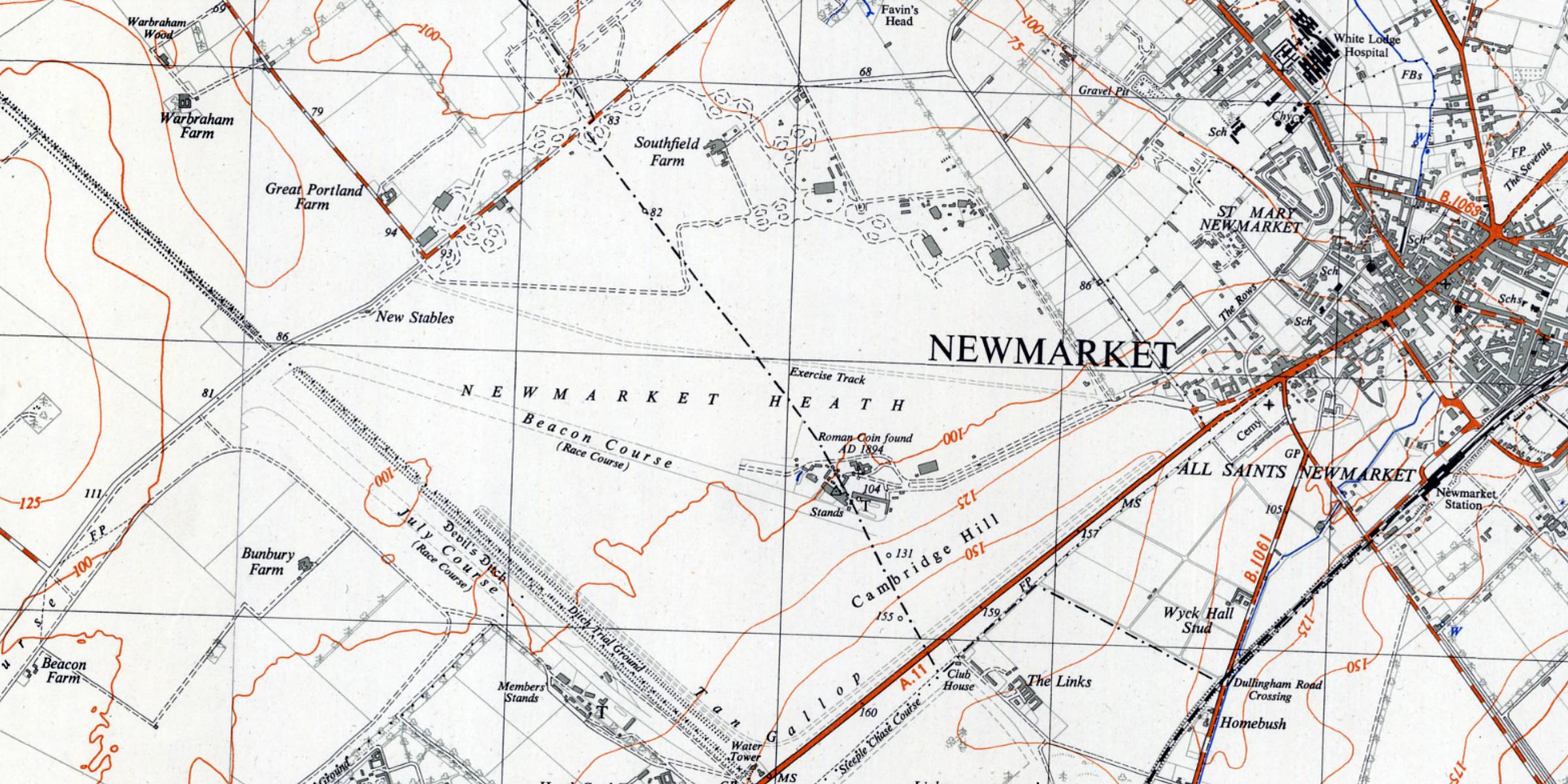 Map of the Newmarket Heath TL66, Surveyed: 1938 - 1950, Published: 1955 [Reproduced with the permission of the National Library of Scotland] |
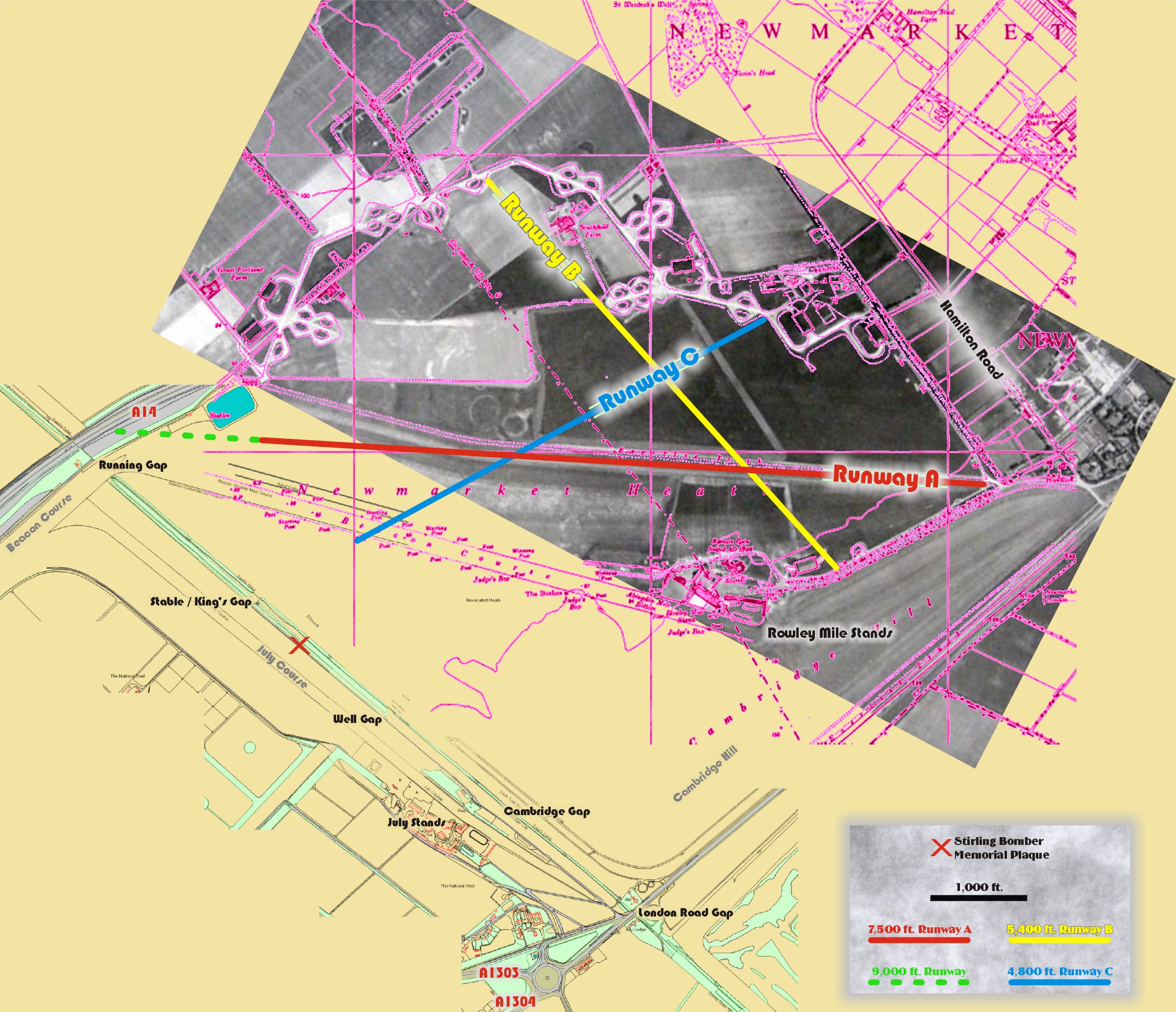 Overlaid Map of Newmarket Heath - showing the hard standings, hangars and runways of RAF Newmarket (see below for further details) [click on the image for a larger view] |
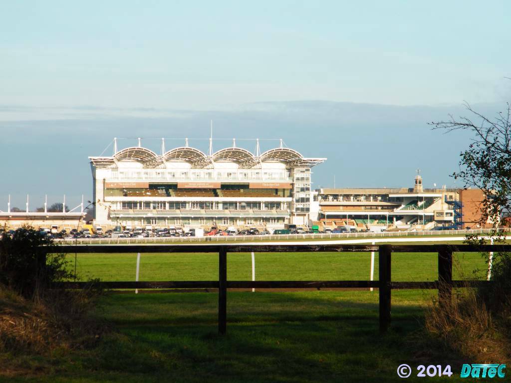 The Millennium Grandstand on the Rowley Mile - looking through the Cambridge Gap, adjacent to the winning post on the July Course |
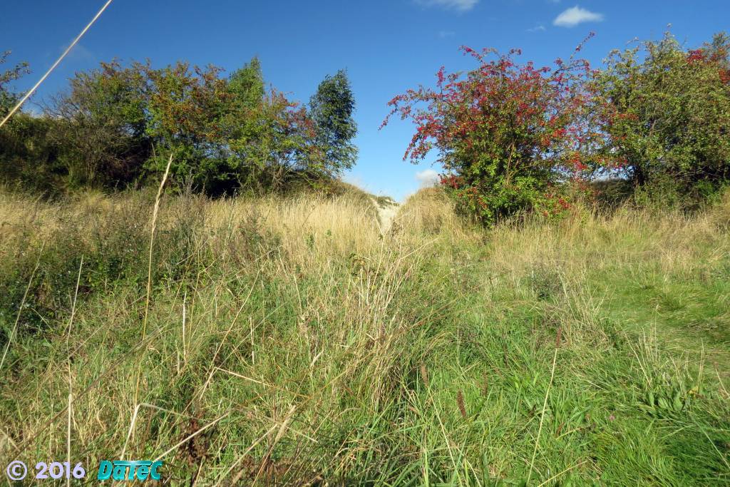 Looking through the Well Gap from the July Course side |
| Evening Despatch, West Midlands Thursday 13 May 1943 NEWMARKET THE Newmarket race meeting: arranged to take place next Tuesday and Wednesday has been postponed for a week The reason for the postponement is that one of our planes crashed on the course last night and caused damage which will take some days to repair. The occupants of the plane were killed when the machine crashed near Devil’s Ditch. "I heard a heavy thud," a Newmarket resident told reporter. "Soon afterwards the area was lit up by the glare of the burning plane." A statement was issued to-day by Messrs, Weatherby, which read: THE NEWMARKET SECOND SPRING MEETING HAS BEEN POSTPONED AS RACING IS UNAVOIDABLY PREVENTED FROM TAKING PLACE AT NEWMARKET ON TUESDAY AND WEDNESDAY OF NEXT WEEK. The Two Thousand Guineas was to have been run on Tuesday next and the One Thousand Guineas on Wednesday next. The stewards of the Jockey Club have ordered that the whole of the races fixed for those days shall be run on Tuesday and Wednesday, the 25th and 26th May. The meeting of the Jockey Club fixed for Tuesday next has been postponed till Tuesday, 25 May. |
- No. 2 Squadron RAF detachment (March 1943) - North American Mustang I.
- No. 453 Squadron RAAF (1943 for one week) - Supermarine Spitfire VB.
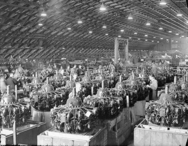
- No. 54 Maintenance Unit RAF (1st March 1945 until 31st January 1948)
Re-serviced and repaired aircraft engines being prepared for despatch overseas at No. 54 Maintenance Unit, Newmarket, Suffolk.
By Miller D W (Flt Lt), Royal Air Force official photographer
- This is photograph CH 16655 from the collections of the Imperial War Museums.,
Public Domain, https://commons.wikimedia.org/w/index.php?curid=28193111
 |
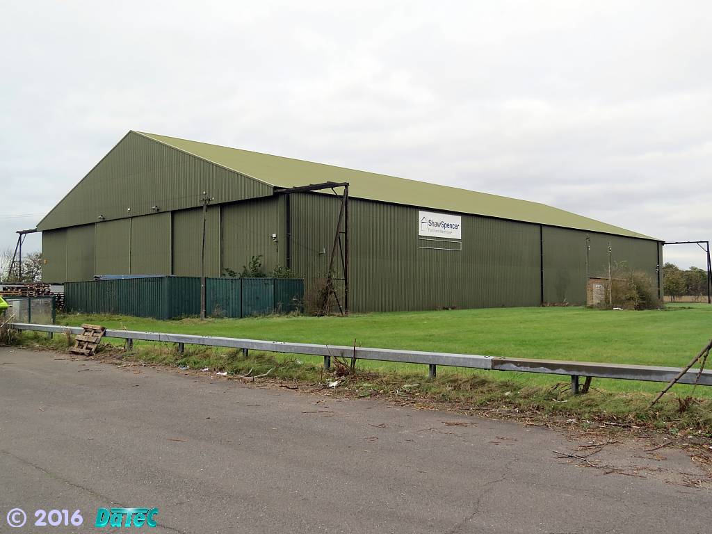 |
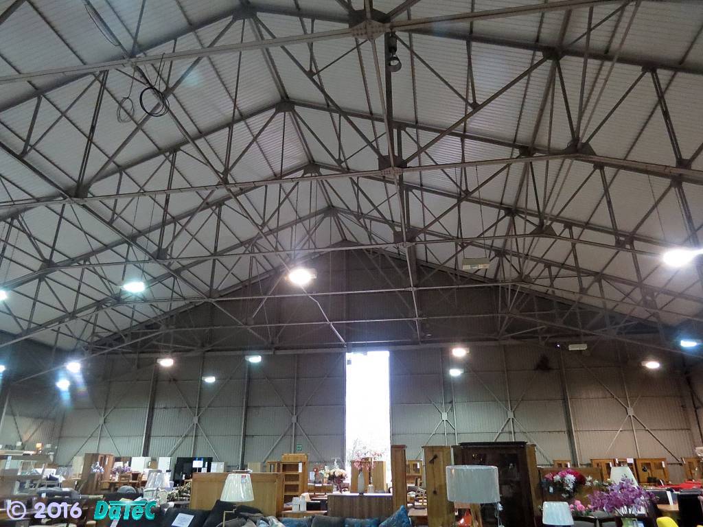
The only remaining B1 hangar at Newmarket - now used as Furniture Warehouse Shaw Spencer
- photos taken on 25th October 2014.
The other of the two B1 hangars that remained at this base had been kept in use for commercial storage of waste paper, but it was destroyed by an arsonist in 1997.
An almost identical structure has been built in its place - but the cleanliness of its outside cladding betrays its recent construction.
 |
|
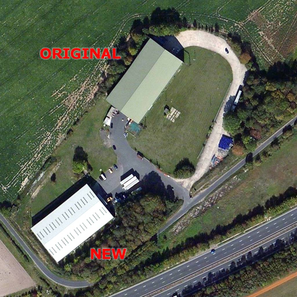 Aerial view showing the remaining original B1 hangar and a new similar building next to it, that stands on approximately the same site as the other B1 hangar (the combined A14 / A11 Newmarket Bypass can be seen in the bottom right corner) |
 Section from 1944 map above showing both the original B1 hangars (this shows that the combined A14 / A11 Newmarket Bypass has cut right through the location of the aircraft hard-standing loops ... also the route of Old Swaffham Road has changed very slightly, with the original T-junction being replaced by a sweeping bend, and the road in the bottom left hand corner that previously carried on towards Swaffham Prior is now just a grass track) |
| For
those at least curious about what that small black
rectangle located in front of the upper B1 hangar was
used for ... on a fully itemised RAF map of the airfield they're listed as the 'Technical Latrines' and a 'General Purpose Hut' ... presumably therefore the loos for the Technical staff .... now you know! |
|
 https://en.wikipedia.org/wiki/RAF_Newmarket
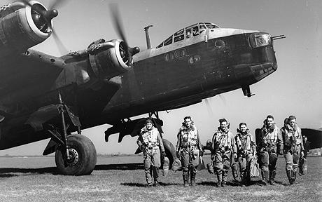
- During the war 76 bombers are known to have been lost in the course of flying operations from Newmarket. Wellingtons accounting for 33
and the remaining 43 were Stirlings. By the early spring of 1945 Newmarket
was no longer needed as an active airfield and its two B1 hangars, which
had been erected in 1942, were taken over by No. 54 Maintenance Unit.
-
Following VE Day (Victory in Europe Day) the air base was mostly stood down from active service, but the RAF didn't immediately
vacate Newmarket Heath.
In September 1945 the July Course gave up its starring role as being the only racecourse at Newmarket and racing at the Rowley Mile returned in the summer of 1946.
Prior to this happening though the various on-site buildings had to be put back to race-track order and fortunately as cuttings had been taken from old bushes around the site, Major Gorton, now clerk of the course, arranged to have these replanted to give the course a facelift.
Crashed aircraft rescue demonstration. Newmarket, Suffolk
- short silent film showing a ground-based fire drill, filmed at RAF Newmarket using an Avro Lancaster
[click on the play button above to start the video]
-
Lowering of the Devil's Dyke
-
Due to the many aircraft mishaps at this airfield that involved crashing into or
clipping the top of the Devil's Dyke, part of it was lowered in
1943.
The photo below, taken of one the many races that still persisted on the July Course during WWII, shows an excavator working on the racecourse side of the embankment, somewhere near where the fateful 5 furlong marker crash occurred, as detailed above.
Excavator working on the Devil's Dyke c.1943
- photo courtesy of Rodney Vincent of the Newmarket Local History Society
-
Evidence for this location of this lowered section can be clearly
seen in the Bing Maps aerial views for the King's
/ Stable Gap, and on the ground the following set of photos show
the area quite clearly.
-
According to Nick Patton, Jockey Club Estates Training Grounds
Manager, who maintains the Newmarket Heath, the lowering of the
Devil's Dyke, which of course is an ancient monument, involved an Act of Parliament - but unfortunately the
documentary evidence of this has yet to be found.
-
It's all about the wind ...
-
[Note from webmaster - the following conclusions are not based
upon fully documented evidence, but have been calculated from the scant
records that we do have and following detailed discussions
between myself and Tony
Pringle; who has a detailed knowledge and interest in all things military.
We've therefore produced our own ad-hoc survey; using
both the topography of the area and our knowledge of the prevailing wind
conditions in this part of the country.
Remember that this is a fully grassed area, with no permanent tarmacked runways (these would have been too obvious targets for any enemy bombers). There's some evidence detailing that there were 3 main runways that the RAF constructed here:-
Runway A East to West @ 7,500 feet (2,286 m)
Runway B South East to North West @ 5,400 feet (1,646 m)
Runway C North East to South West @ 4,800 feet (1,463 m)
The starting points of these runways is also roughly known.
Let's consider both the Vickers Wellington and the Shorts Stirling. Fully laden with bombs, both these aircraft were very heavy and needed every help they could get from a head-wind to get them into the air in a sensible distance.
As the war progressed both these aircraft designs were modified, based upon proven experience. The Wellington, which had a maximum speed that ranged from 170mph up to 235 mph, and with only 2 engines producing a total of just 2,100 hp, it needed a very long runway to get airborne.
Clearly this aircraft had to make use of the longest stretch of grass available here at Newmarket and with the prevailing winds in this locale coming from approximately just south of west, the longest East to West Runway A is the only track that best satisfied these requirements.
It would seem that when the RAF engineers initially surveyed this area at the beginning of the war that this runway was aimed approximately at the Running Gap - but remember that the Jockey Club still had significant influence here, and they wouldn't have wanted these aircraft taking off too close to any of the July Course (that was still operating as a race venue during this period). Based upon this it would seem that this runway had to be pointed very slightly further north of this location. Plus of course the prevailing wind direction also had the effect of veering the ascending aircraft into this direction.
Unfortunately this therefore aimed the planes directly towards what is one of the highest points of the Devil's Dyke along here, and remembering that these heavy bombers were still only just a few feet above the ground when they came over here, it becomes clear that this was an accident waiting to happen .... and both of the documented Wellington crashes of No. 99 Squadron RAF detailed above were caused by the aircraft clipping the Dyke at this location.
The Shorts Stirling was a slightly more powerful aircraft and in 1936 had a maximum design speed of 275mph (this was actually reduced later on), and with 4 engines producing a total of 5,500 hp, this aircraft was able to get airborne in slightly shorter distances. So the shortest North East to South West Runway C best fitted these requirements.
In plotting this runway on the Overlaid Map shown above, it would seem that those same RAF engineers planned to have this runway pointing directly at the King's / Stable Gap - a 'natural' gap in the Dyke that they would have deemed to have made best use of.
-
It's interesting to note that many other of the local
airfields in this area - Lakenheath (237°), Cambridge (232°), Oakington
(230°), Stradishall (220° & 250°), Duxford (240°), Fowlmere
(250°) and Coltishall (220°) are all pointing
roughly in the same direction as that here .... Runway C on the above map
is at 241°.
The reason for this is that all these runways are of course pointing into the predominantly prevailing wind direction, which in East Anglia I'm reliably informed by the owner of the Mid Anglia School of Flying (MASF) is from just south of west - coming from ~235°, ±5°.
[Before anybody emails me, I know that Magnetic North is constantly drifting with respect to True North, and that these runway figures are updated as necessary to compensate for these changes - but they serve to represent the comparatively similar directions that all these runways have.]
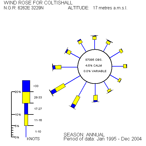
The above image is a wind rose diagram - where the length of the coloured blocks shows the strength of the wind, all arranged around the points of the compass. It shows that for RAF Coltishall in Norfolk, averaged across the year, the prevailing wind direction for this location is once again from just south of west.
-
Unfortunately it would seem that on many occasions the wind during the
war years had not been in the most ideal direction and frequently had come from a
slightly more northerly direction. The aircraft are fine following the
241° direction of this track on the ground, but as soon as they become
airborne the wind takes over and it would seem that many were driven south of the gap in the Dyke and hence
resulted in the accidents that occurred.
[I don't think that this wind variation is particularly unusual on the Devil's Dyke; as on the day in 2016 that many of the photos were taken as shown on this page, the wind was doing just that - coming from a slightly more northerly direction.]
So the conclusion here is that because of these continuing tragic events, that in 1943 the Dyke had to be lowered just south of the King's / Stable Gap. As detailed above, evidence for this location can be clearly seen in the Bing Maps aerial views for the King's / Stable Gap.
Runway B, going from South East to North West, would have been for those odd occasions when the wind was in a completely different direction, or it could have been used as a landing strip, when apart from if the cross-winds were too strong, the general wind direction was less critical ... and of course having deposited their bombs the aircraft were then also much lighter at this point.
Any comments on these conclusions would be most welcome - please E-MAIL.]
-
The ATC at Newmarket
- As detailed on the page for Crisswell's Garage - No.170-176 High Street, my Dad started his career there as a motor mechanic
jast after the end of WWII in 1945.
The General Manager at the time was a Mr. Dunham. It was his wife who used to run the Air Training Corp (ATC) here in Newmarket and invited my Dad to join them. They had their meetings on the other side of the road at Lushington House - No.119 High Street and Mrs. Dunham used to take refreshments over there from the garage.
The RAF used to take members of the ATC up for short 'experience' flights in various aircraft. On one occasion about 6 of them, my Dad included, were taken up in a De Havilland Dominie Dragon from here at the airbase. My Dad recounts how after take-off the Canadian pilot took the plane up in a very steep vertical climb, and then when high enough went over the top and came back down in a very steep groundward dive, trapping everyone very tightly back into their seats - quite an experience for young teenage lads.
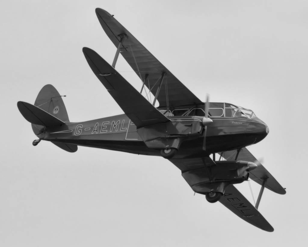
De Havilland Dominie Dragon
The other flight he was taken on, whilst still at Newmarket, was from a makeshift airstrip on the other side of town ... on the track that comes off the Thetford Road near the Limekilns and runs across Water Hall Heath on its way towards Chippenham Park. This flight was in a Lysander, and just recently while taking my Dad around Duxford IWM he was very excited to see one of these again ... strung up in mid-air from the ceiling.
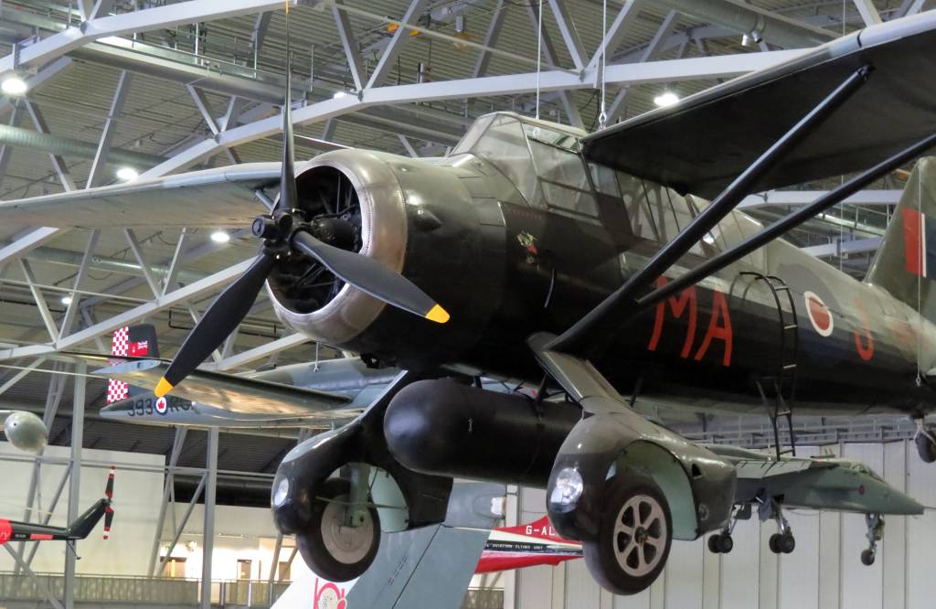
Lysander at Duxford Imperial War Museum
-
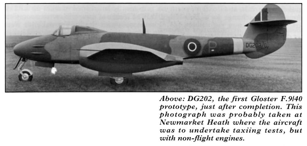
Gloster Meteor DG202
- One other highly important event that happened here at RAF Newmarket
during WWII was the very early trials of Britain's first
jet-engined aircraft - the Gloster Meteor. The following is a transcription
of events from just before to just after its time
here at Newmarket:-
- Order from Ministry of Aircraft Production for 12 prototype F9/40 ‘Gloster-Whittle’ twin-jet interceptors (unofficially known as the Rampage at this time) - serialled DG202-DG213 of which 8 eventually flew (DG202-209), each with different engines.
Contract No. SB21179/C.23 (a).
Under construction by Glosters at Brockworth by autumn 1941 using components from a variety of sub-contractors including Boulton Paul and Parnell Aircraft Ltd.
Given the ‘G’ suffix to its serial number to denote a high security aircraft, to be guarded at all times when on the ground.
In February 1942 the name ‘Meteor’ had been allocated for the aircraft by the Ministry of Aircraft Production. - First ground run at Gloster’s Bentham factory with two ‘ground-only’ Rover built W.2B/23 engines.
These were derated to give 1,000lb of thrust each and were not passed for flight because of unreliable turbine blades. - By road to RAF Newmarket Heath, near Cambridge with outer wings removed, for ground running and taxiing trials.
- Taxiing trials commenced on the 9,000 foot strip at
Newmarket Heath with Flt Lt P.E.G. ‘Gerry’ Sayer at the controls. These included two attempted take-offs; at the second attempt the aircraft left the ground for a short hop about six feet off the ground after an 1100 yard run.
The photo above was probably taken at this time - Air Pictorial July 1994 page 299.
Taxiing suspended due to undercarriage problems. - Taxiing trials resumed after Hawker Typhoon wheels and tyres fitted.
- Taxiing trials completed by the middle of the month and the ‘ground-only’ engines removed to await the delayed delivery of new W.2/500 engines from Rovers, one of which blew up on the test bench.
Aircraft stored in Ministry of Aircraft Production blister hangar at Newmarket.
Sister aircraft DG206 was actually the first to fly on 5th March 1943. - By road to RAF Barford St. John aerodrome near Banbury, Oxon. The aircraft then stood idle for two months undergoing various modifications and was also robbed of many items for use on other Meteor prototypes.
-
Racing during the war
- Most sporting programmes were halted during WWII, but due to
pressure from the Jockey Club
Newmarket racing continued on the July Course.
There were occasional events at other racecourses, but as well as maintaining much of its own racing calendar, the July Course also hosted major classics such as the Derby, which became known as the New Derby at Newmarket, the Oaks from Epsom and the Ascot Gold Cup.
One main reason behind the decision to continue was that racing was (and still is) big business in the town and Newmarket had no other major industry at that time to keep it going.
-
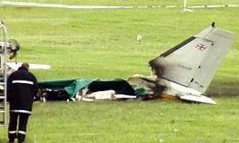
Newmarket Airfield
-
The grass strip airfield here is still kept in use today, most
notably during race meetings, and was the scene of an air crash
involving a Piper Seneca on Thursday 1st June 2000, in which the
pilot was killed and jockeys Frankie Dettori and Ray Cochrane were
injured.
- Return to top of page
 Lowered section of the Dyke from the end nearest the 4 furlong marker, looking north west towards the King's / Stable Gap, which is adjacent to the 5 furlong marker on the July Course |
|
 Memorial plaque for the crashed Stirling bomber, adjacent to the lowered section of the Dyke, looking south east |
|
 Lowered section of the Dyke, looking through the King's / Stable Gap towards the Millenium Stand on the Rowley Mile |
|
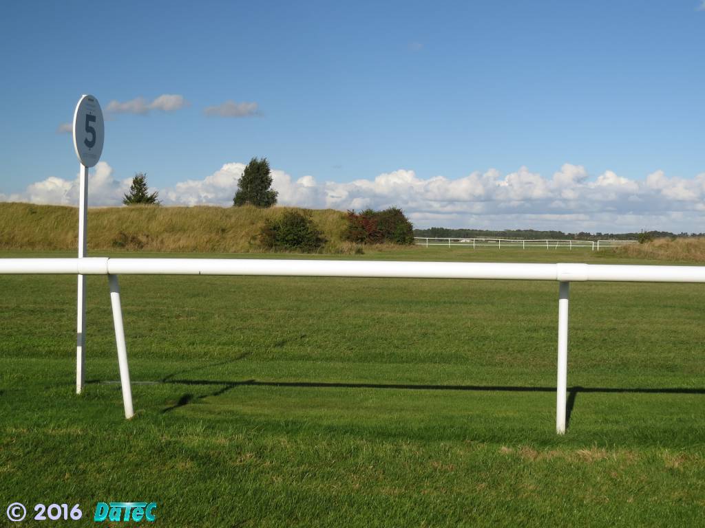 5 Furlong Marker on the July Course looking through the King's / Stable Gap - the lowered section is on the right |
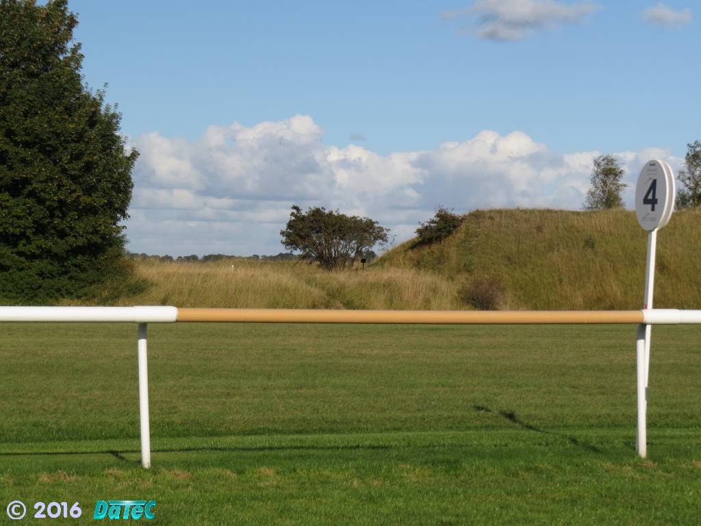 4 Furlong Marker on the July Course looking towards the Memorial Plaque, at the southern end of the lowered section |
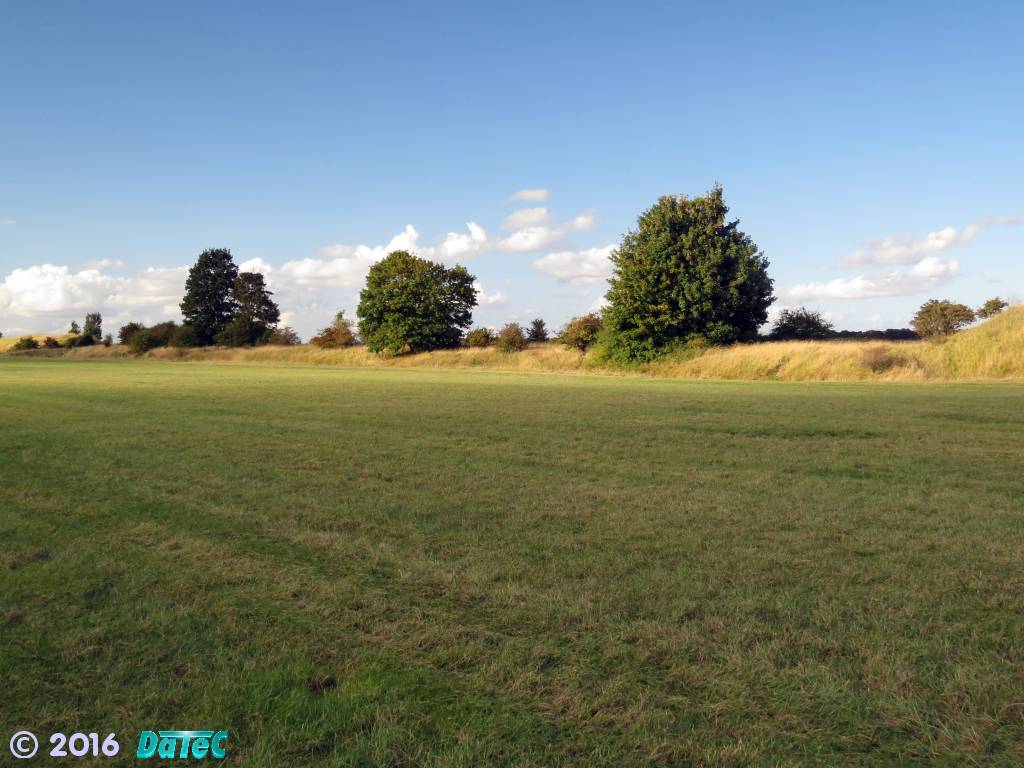 Full length of the lowered section looking north from the July Course |
|
 Air Pictorial - July 1994 - page 299 |
|
[click on the play button above to start the video] |
| Gloster F.9/40 Meteor Prototype DG202/G/5758M 7th February 1941 29th June 1942 2nd Jul 1942 10th July 1942 18th July 1942 Aug 1942 22nd May 1943 |
|
[click on the play button above to start the video] |
||
|
[click on the play button above to start the video] |
||
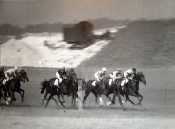
| This
film shows the crowd mingling around the July Course before the Derby. Then King George VI, Queen Elizabeth (later the Queen Mother) and Princess Elizabeth (later Queen Elizabeth II) are seen walking through the crowd. The horses and jockeys are then shown after the race, with the winning jockey dismounting from his horse. The King, along with others gather around to discuss the results. |
||
|
[click on the play button above to start the video] |
||
| IMPORTANT
NOTE from the WEBMASTER Content on this web site is attributed as appropriate to its original source or supply - can I ask that any copying or subsequent citation should respect the original author(s) and reference them or this web site as the source of this material Thank you |
|
| © 2016 | |